Local Historian, Farmer, & Prairie Conservationist
ARTIST BIOGRAPHY:
~*~ IN MEMORIAM ~*~
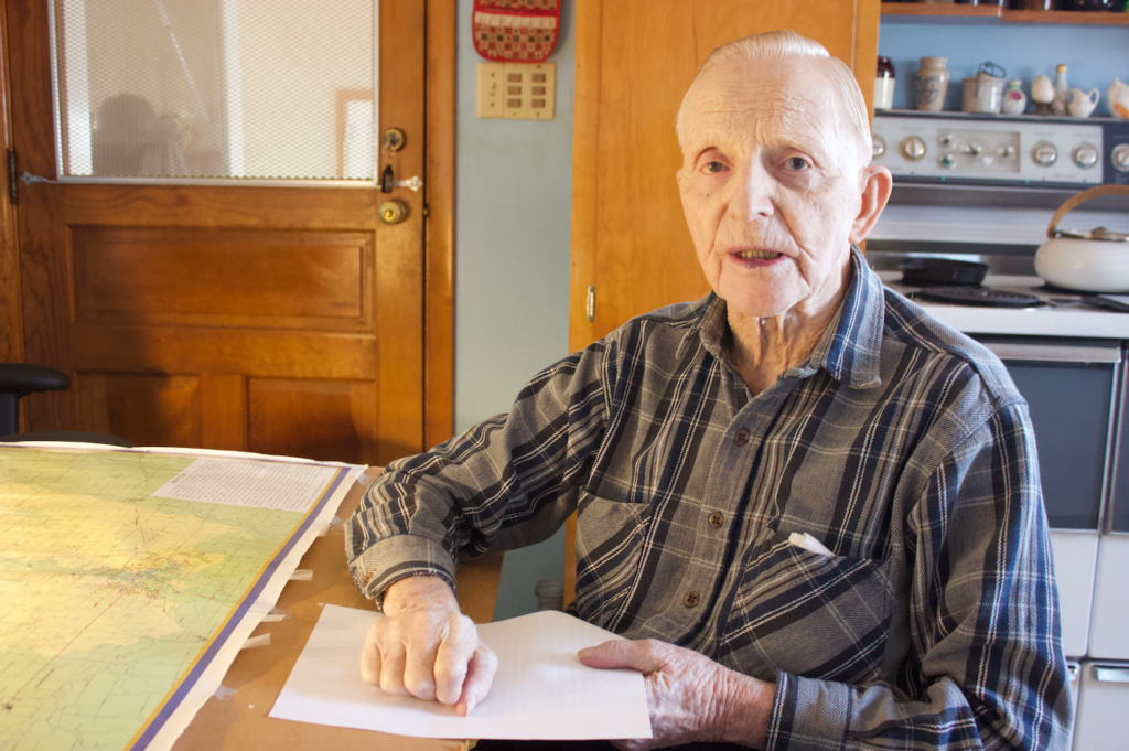
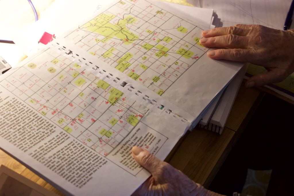
Kensel Clutter, age 100, was a widely-beloved Marion County farmer, historian, conservationist, and prairie restorer who single-handedly mapped Marion County’s historic Owl Creek Trail & once widespread Sandusky Plains. Born on the Marion County’s “mile” — where a set of long-tenured farming families have lived as neighbors for almost two centuries — Kensel got involved in local history work after returning to Marion County from service in the Pacific during WWII. Kensel became one of Marion County’s most accomplished & dogged of local historians. In the 1970s & 1980s, he set about single-handed mapping the Owl Creek Trail: an important multi-tribe indigenous path (a former buffalo trace) crossing the Sandusky Plains down to the Kokosing River (then, Owl Creek). Kensel worked extensively with a local cartographer to fully map the Marion County portion of the trail from the original 19th-century platting surveys and remaining surveyors’ stones. He then, in collaboration with Trella Romine and the amazing community of activists who helped build the Marion County Historical Society during its heyday, set about on another ambitious, era-defining project: using historical sources from early Marion County settlers to map the famed Sandusky Plains — one of Ohio’s only original prairie lands — when he noticed remnant native prairie plants growing in a patch of his farmland. Once Kensel had mapped the Sandusky Plains, he set about restoring acres of native prairie throughout Marion County.
Kensel was a rare one — a dedicated & extremely talented local historian & restorationist committed to making Marion County’s indigenous & pre-settlement history visible on the map; and passionately committed to the intersection of natural & cultural history, and our county’s ecological futures.
Kensel Clutter is the author of several books; his biographies & historical treatises on the Owl Creek Trail & Marion County’s Sandusky Plains, along with his celebrated maps, are available in the gift shop of the Marion County Historical Society. All proceeds benefit the Marion County Historical Society.
Rest in peace, Kensel. You will be sorely missed.
SHOP // ADDRESS:
Visit the Sandusky Plains or Trella Romine prairie in honor of Kensel’s legacy in Marion County prairie identification & restoration.
Marion County Sandusky Plains & Prairie Sites:
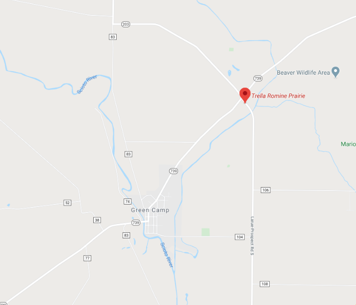
Trella Romine Prairie: located to the north of the Village of Green Camp near the intersection of Marion-Green Camp Road (Highway 739) and Larue-Prospect Road South (Highway 203).
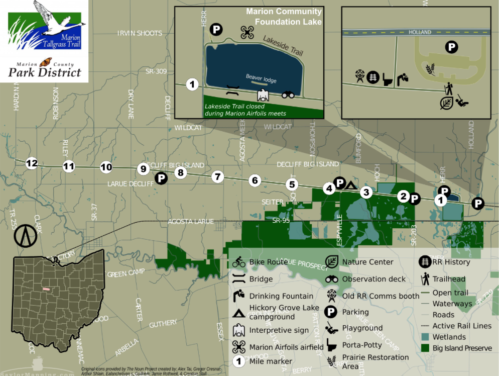
Marion County Park District Tallgrass Trail: The Tallgrass Trail is Marion County’s flagship “rails-to-trails” project, covering almost thirteen miles of land along the original Sandusky Plains, heading west from Marion City to the Hardin County Line. The Tallgrass trail follows the former Erie-Lackawanna railroad line through the once-bustling railroad depot villages of Espyville & Decliff, crossing many restored tallgrass praries. What better way to explore Marion County’s prairie & plains histories & Kensel Clutter’s legacy than by exploring our natural heritage on bike?
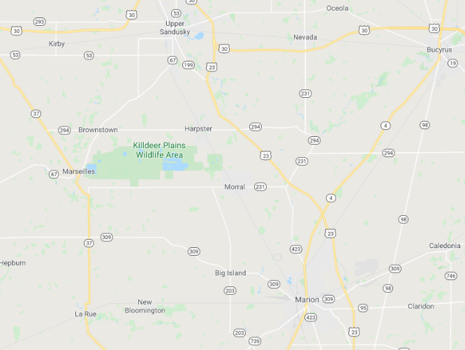
Killdeer Plains Wildlife Area: Located about eight miles west of Marion, eight miles south of Upper Sandusky, near the corner of Wyandot and Marion County. Accessible via SR 294 to Wyandot County Road 114 west of Harpster; or off SR 309 in Western Marion County from Caledonia to LaRue. The GoogleMaps address is: 191000 County Highway 115 — Harpster, Ohio || 43323. The Killdeer Plains Wildlife Area is managed by ODNR.
SERVICES:
History writing; mapping; native plant restoration
GENRES:
Local history; indigenous history; natural history; cartography; conservation; prairie restoration
PHOTO GALLERY: